|
|
The Coalinga Anticline and the
Coalinga Earthquake of 1983
 The Coalinga earthquake was a 6.5 magnitude event on the Richter scale that struck downtown Coalinga on May 2, 1983 at 11:42 in the evening. The quake was caused when Anticline Ridge, just north and northeast of town, was pushed up and out to the south about 1 to 2 feet along a reverse fault, 10 km down, that forms the core of the fold, which is known in the oil fields as the Coalinga Anticline. Although the main quake caused virtually no surface rupture, an aftershock five weeks later on June 11 - one of over 5,000 recorded - did break ground about 12 km northeast of town. The Coalinga earthquake was a 6.5 magnitude event on the Richter scale that struck downtown Coalinga on May 2, 1983 at 11:42 in the evening. The quake was caused when Anticline Ridge, just north and northeast of town, was pushed up and out to the south about 1 to 2 feet along a reverse fault, 10 km down, that forms the core of the fold, which is known in the oil fields as the Coalinga Anticline. Although the main quake caused virtually no surface rupture, an aftershock five weeks later on June 11 - one of over 5,000 recorded - did break ground about 12 km northeast of town.
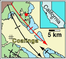 The red line on the geologic map at right shows the axis of the Coalinga anticline, and the red dot represents the epicenter of the 1983 earthquake. Quaternary rocks are shown in light blue, Tertiary rocks are green, and Cretaceous rocks are brown. The red line on the geologic map at right shows the axis of the Coalinga anticline, and the red dot represents the epicenter of the 1983 earthquake. Quaternary rocks are shown in light blue, Tertiary rocks are green, and Cretaceous rocks are brown.
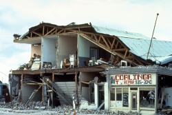
Damage from the quake was most severe in the eight-block commercial downtown district from Third to Seventh Street, and between Durian and Forest Streets, where 59 of 139 buildings collapsed or were heavily damaged. Older pre-1930s brick buildings, as might be expected, received the most damage, and newer buildings of reinforced concrete or pre-fabricated metal faired much better. There was also intense damage in the residential part of the city and more than eight-hundred family homes were destroyed or heavily damaged.
There was also heavy damage to the oil fields near Coalinga, which to date have produced over 900 million barrels of oil from the Coalinga Anticline. Pumping jacks were thrown out of alignment, causing production to stop, and pipelines and storage tanks damaged. One oil company building, about 7 kilometers north of town near the crest of the anticline, lost two of its brick chimneys. In addition, there was collapsed or parted well casing in 14 of the 1,725 wells that were active in the field at the time.
This earthquake also triggered thousands of rockfalls and landslides in the mountains west of town, as far as 34 kilometers northwest, 15 kilometers south, and 26 kilometers southwest from the epicenter. However, this was due to the steep slopes in these mountains, which obviously are still growing, and there were virtually no slope failures in the flat plains to the east.
Photos of the Coalinga Earthquake of 1983
 |
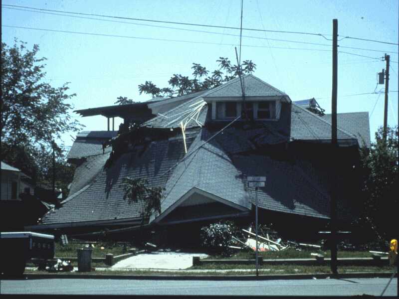
More than 800 private residences in Coalinga were destroyed or heavily damaged by the earthquake, and most of the 94 injuries happened in the residential parts of the city. |
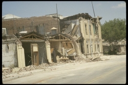 |
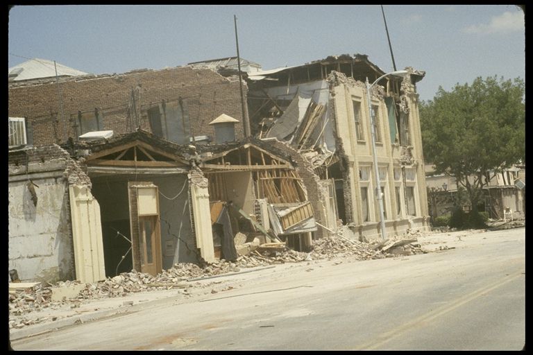
Extensive earthquake damage to buildings in the downtown area of Coalinga. |
|
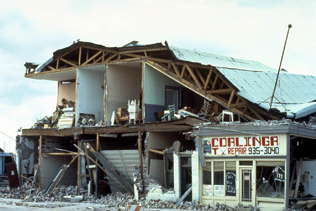
Shaking from the quake sheared off the entire front of the Coalinga TV repair building at 187 South 6th Street. |
 |
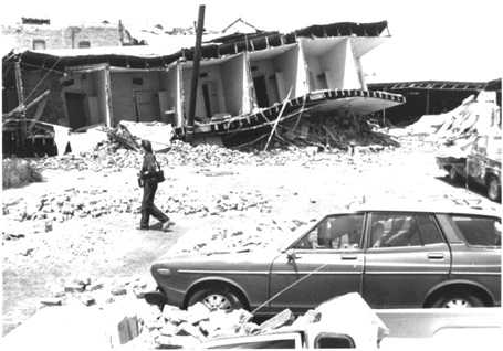
Heavy damage to a building on 5th Street, in the downtown part of Coalinga. |
|

|