
The White Wolf Fault and the
|
| The map above shows 1986-1996 earthquake activity in the White Wolf Fault area. The heavy red lines represent surface ruptures from the 1952 Kern County earthquake, and the red star indicates the epicenter for the main quake. |
The White Wolf Fault at one time was not considered to be a major threat - most seismologists believing that it was not long enough to generate a sizeable tremor. However, when the Bakersfield Earthquake hit at 4:52 am on July 21, 1952, with up to 4 feet of elevation change, it caused severe damage as far away as Las Vegas (see the isoseismic damage map below). Twelve lives were lost, and there was at least $50 million in property damage. In addition, there were at least 20 aftershocks 5th magnitude or greater associated with the initial 7.5 magnitude shock, including a 5.8 magnitude tremblor that hit nearly a month later on August 22.
Photos of the Kern County Earthquake of 1952
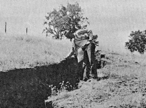 |
A vertical fracture along the White Wolf fault near Bear Mountain on the east side of the San Joaquin Valley. The vertical displacement at this break was about 2 feet with a horizontal (left-lateral) displacement of 1.5 ft. On other places as much as four feet of displacement was observed. (photo: University of California) |
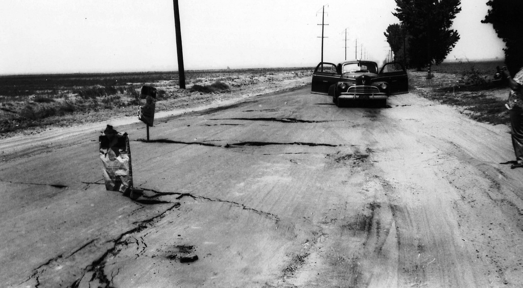 |
Collapse of a roadbed along the Bear Mountain Road near Weedpatch when shaking from the quake caused liquefaction of soil beneath the road. |
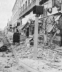 |
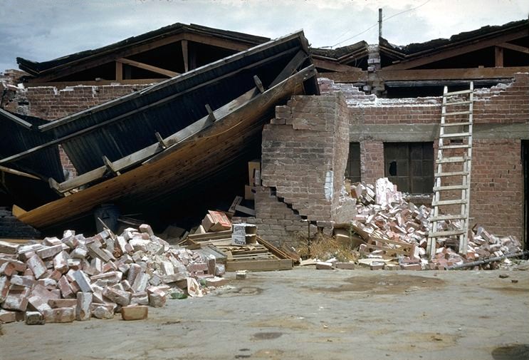
Destruction in downtown Bakersfield resulting from the August 22 aftershock of the main quake. Although this was only the fifth strongest aftershock, the epicenter was very close to Bakersfield, and it has a severe impact on buildings already weakened from the main quake a month earlier. |
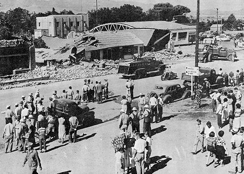 |
Destruction resulting from the earthquake along Main Street in Tehachapi. (photo: World Wide Photo) |
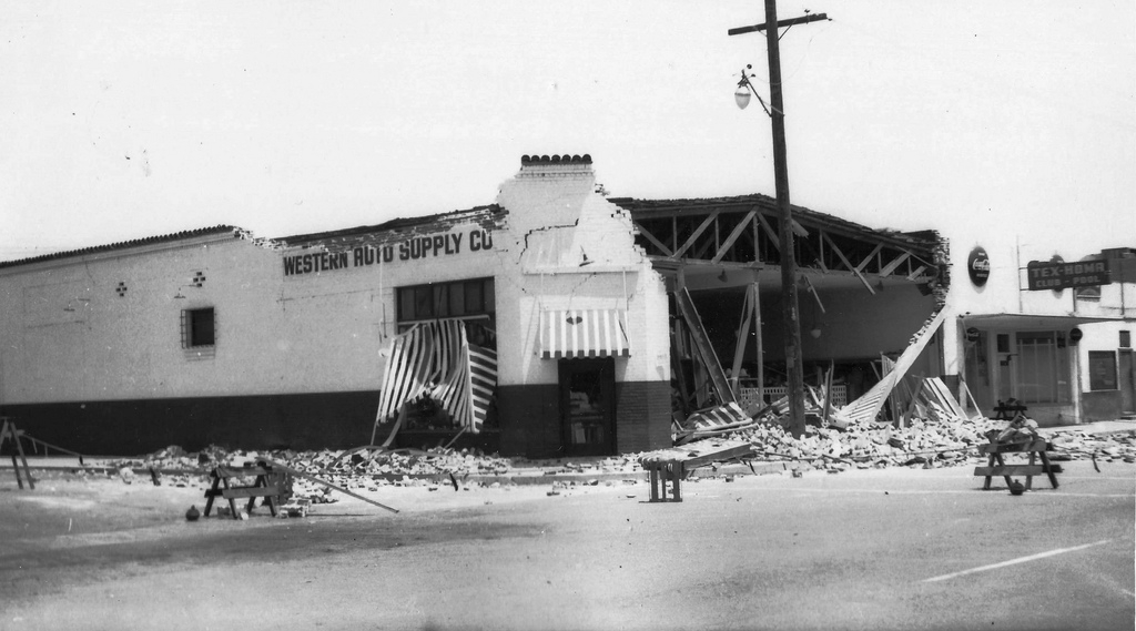 |
Partial collapse of the Western Auto Supply Co. Store in Arvin. |
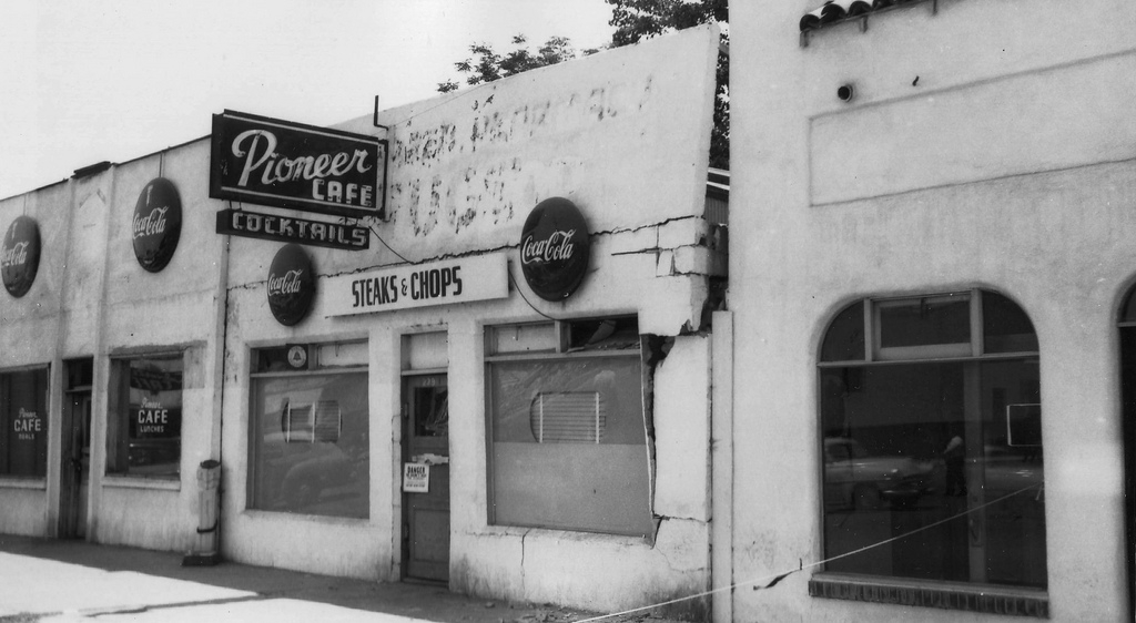 |
Heavy structural damage to the Pioneer Cafe in Arvin. |
 |
Destruction to the rear of buldings on Main Street in Tehachapi. (photo: Steinbrugge Collection, Earthquake Engineering Research Center, UC Berkeley). |
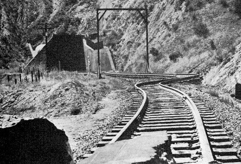 |
Railroad tracks near Bealville, in the hills east of Bakersfield, where rails were were bent and twisted by the earthquake. (Photo: National Geophysical Data Center) |
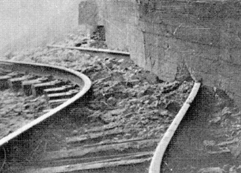 |
A close-up of rails near Bealville that were bent by the earthquake. Notice that one rail is continuous beneath the tunnel wall, indicating that the wall was lifted up enough for the rail to slide underneath. (photo: Southern Pacific Railroad) |
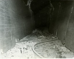 |
Earthquake damage at the east portal of Tunnel 3 on the Bakersfield to Tehachapi route, close to the above two photos. Again notice how it appears that the tunnel wall was lifted up and dropped onto the rails. |
 |
Earthquake damage to a cement diversion dam in the Kern River Canyon. The Kern River Canyon Fault, which is thought to be inactive, is more or less a continuation of the White Wolf Fault and passes beneath the Lake Isabella Dam upriver from where this photo was taken. |
| FORMATIONS |
| Tulare |
| San Joaqiun |
| Etchegoin |
| Monterey |
| Temblor |
| Lodo |
| Tumey |
| Kreyenhagen |
| Moreno |
| Panoche |
| Strat Charts |